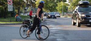
Cyclists at the Clegg-Colonel By intersection before the Flora Footbridge and the safe Colonel By crossing were built. The City plans more improvements through the new active transportation plan. Photo by John Dance
By John Dance
Work on the City’s new active transportation plan (ATP) forges ahead with a number of potential improvements proposed to benefit local pedestrians and cyclists.
At a consultation session held this summer, residents learned that a number of “missing-links” – including the dangerous Bank Street bridge over the Rideau River – will be addressed although the projected timelines vary.
This year, the City will consult on options to make the Billings Bridge of Bank Street safe for pedestrians and cyclists. One option is to replicate what the improvements to the Bank Street Canal Bridge by removing a vehicular lane and making separated cycling and walking facilities on each side of the bridge.
As for the OOECA-proposed river footbridge in the Clegg – Brantwood Park area, it may be a decade or more before this proceeds. “I do feel some day we will see a bridge there … it’s a great long-term plan but not at the top of the pile over the next 10 years,” commented Zlatko Krstulic, the City’s manager of active transportation planning.
During the session, a number of the active transportation improvements made in Old Ottawa East, including the Flora Footbridge and the rebuilding of Main Street, were cited as primary examples of progress to date.
As early as 2026, the City may create cycling lanes along much of Carling Avenue, a measure that would benefit cross-town traffic west of the Rideau Canal. There are, however, no plans for a new east-west cycling route all the way through the Glebe and Old Ottawa East and on through Riverview Park and farther east.
Other cycling improvements sought by participants included protected bike lanes on both Pretoria and McIlraith bridges, better cycling on Smyth Road, and a safe north-south route through Old Ottawa South.

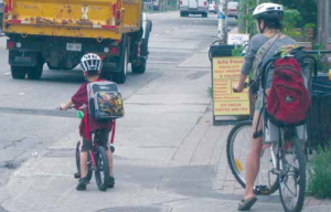
Active transportation infrastructure has improved greatly in central Ottawa since the above picture of Main Street cyclists was taken eight years ago. Photo by John Dance
OOECA transportation director Tom Scott flagged the need for “clear routing” between the Corktown and Adawe footbridges and better signage and cycling facilities at the busy Colonel By Drive – Wellington / Rideau intersection. He also noted, “Active transport planning has to take into account the fact that Ottawa’s surfaces are frozen solid for five or six months of the year and often covered in ice and/or snow.”
“I found the City’s approach refreshing and positive,” commented Don Fugler, year-round Old Ottawa East cyclist. Unlike with the Official Plan process, the planners for the new ATP began the process by asking residents for their ideas then responded in detail to the various ideas.
Capital Ward Councillor Shawn Menard termed the session “productive” and said, “Hundreds of residents joined in and offered thoughtful and important comments and suggestions. Over the next few years, the creation of the new Active Transportation Plan will be incredibly important to the future of Ottawa. We need to offer a wide variety transportation choice as our city continues to grow.”
“Our office has identified many instances of missing infrastructure in Capital Ward, in general, and in Old Ottawa East, in particular—including safe infrastructure over the McIlraith Bridge that will connect to the Rideau River Multi-Use Path,” says Menard.
“We will be working to ensure that these needs are included in the Active Transportation Plan, and we will continue to work with staff to find immediate solutions for our active transportation issues.”
“The ATP is a companion document of the Transportation Master Plan (TMP) and will be consistent with TMP directions,” says Vivi Chi, director of transportation planning. “The TMP will set modal share goals for the ATP and propose spending splits between capital project funding envelopes for all TMP modes.”Unlike the Official Plan, the TMP has been delayed because of the impacts of COVID 19 until 2024. However, the ATP component will be completed by next Spring.


